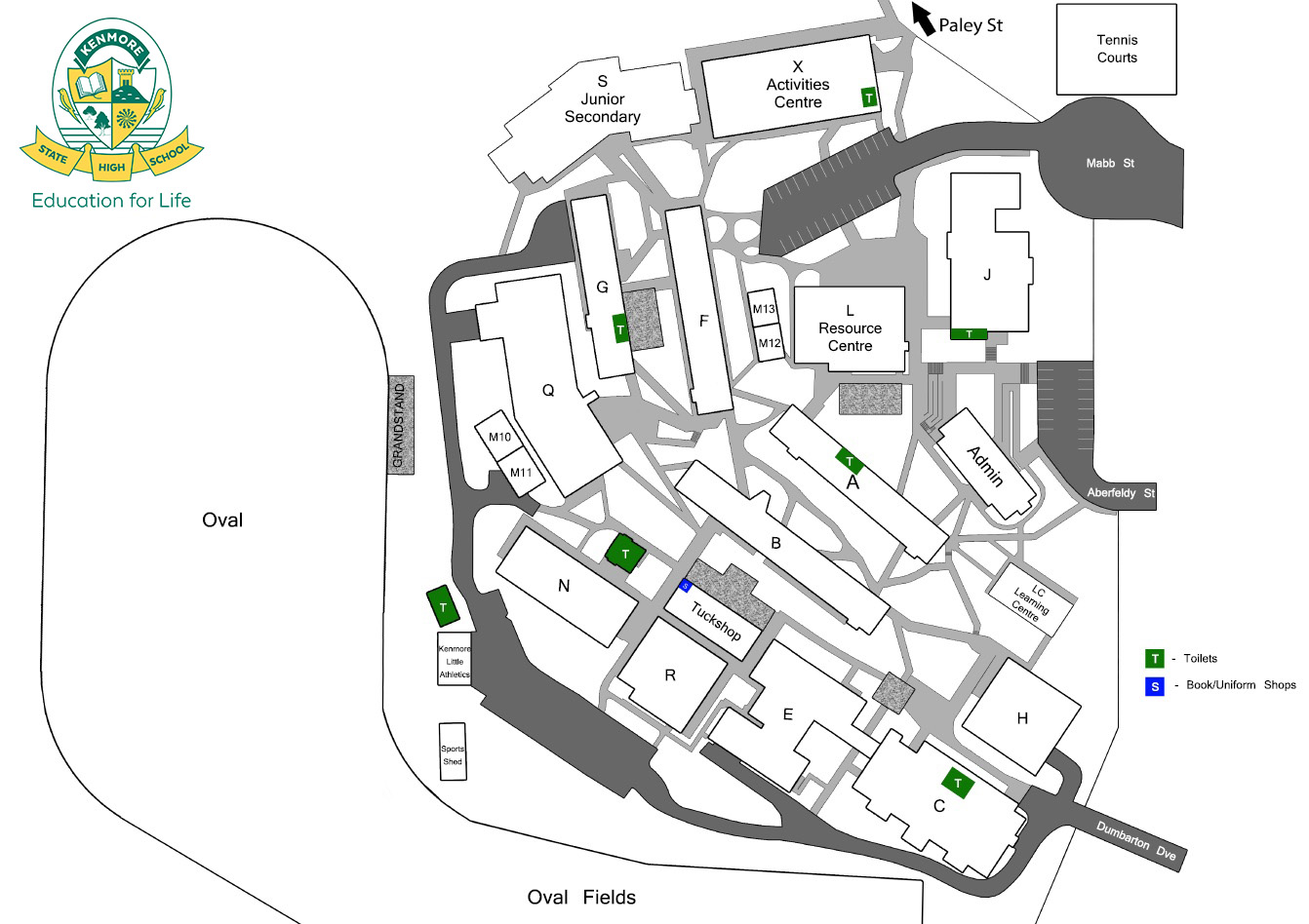
School Map
Please see below for a map of Kenmore State High School.
The School Map is available for download - School Map (JPG, 242KB).
![]()

Public Transport
Bus transport is available via Brisbane City Council bus services or Phone 13 12 30 and Southern Cross Buslines or Phone (07) 3812 2520.
Bike Racks
Bicycle racks are available at each entrance of the school for students who wish to cycle to school. Students are responsible for locking bikes securely.
Drop Off Zones
Mabb Street
Students may be dropped off at the end of Mabb Street with a short walk or at the drop off area before the school gate.
Paley Street
This quiet entrance allows for a short walk past the tennis courts and into the school. This entrance is accessed by turning into Branton Street off Brookfield Road.
Brookfield Road
Students dropped opposite the bus stop on Brookfield Road between Branton Street and Aronia Street can take a short walk through a park to enter the school near Mabb Street.
Dumbarton Drive
A drop off on Dumbarton Drive provides easy access to the school. In the afternoons we separate bus and car students by asking parents to collect students on the left side of the street (outbound) preferably between Lairg & Dumfries Street. We urge care either side of the crest.
Aberfeldy Street
This entrance is not recommended as either a set down or collection point. However, if necessary, a set down near the intersection of Aberfeldy Street and Orkney Street is possible.
We encourage parents to find set down areas and collection points that involve a short walk from the school. This eases congestion and provides for a little exercise.